
OUTDOOR TRAIL MAPS
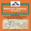
Mount Zirkel Wilderness - Colorado Topographic Hiking Map (2024)
CA$83.31
CA$138.85
-
 Order within 15 hours and 32 minutes to get between June 29 - July 5
 -
 Tracked Shipping on All Orders
-
 14-Day Returns
- Secure Payments
-
 24/7 Customer Support
Description
- Waterproof, tear-resistant, 1:55,000 scale with a compact 4"x7" folded size for your pocket
- Smaller and lighter - no more unfurling huge maps - designed for on-trail use
- Segment distances - mileage - for all trails
- Up-to-date for 2019 with accurate trail routings and distances
- GPS coordinates for trailheads and trail junctions - device compatible
Waterproof, tear-resistant topographic hiking map covering all of the hiking trails in the Mount Zirkel Wilderness in the Park Range along the continental divide in northern Colorado, including a large area of the Routt National Forest north of Steamboat Springs. The front side of the map covers the southern half of the wilderness, from Buffalo Pass north Seedhouse Rd. The back of the map shows the northern portions of the wilderness, including the Continental Divide Trail. The motorized Grizzly-Helena trail along the eastern border is also covered.
Shipping and Returns
- We offer tracked shipping on all orders. Tracking information will be shared as soon as the order is dispatched.
- Please check the delivery estimate before adding a product to the cart. This is displayed for every product on the website.
- Available shipping methods and charges will be displayed at the time of checkout, depending on your exact location.
- All customers are entitled to a return window of 14 days, starting from the date of delivery of the product(s).
- Customers are advised to read our return policy for details of the return process, eligibility, refunds as well as cancellations or exchanges.
- In case of any issues or concerns about Shipping or Returns, please contact us and we will be happy to help.
Outdoor Trail Maps.
Mount Zirkel Wilderness - Colorado Topographic Hiking Map...
CA$83.31
CA$138.85